Geolocate

Candelaria topographic map

Click on the map to display elevation.

About this map

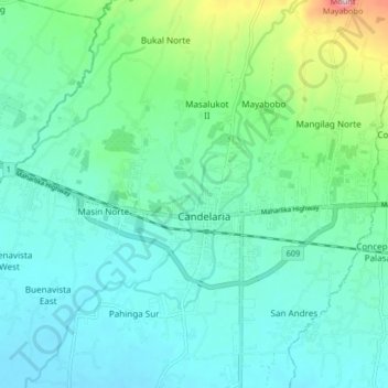
Name: Candelaria topographic map, elevation, terrain.

Location: Candelaria, Quezon, Calabarzon, 4323, Philippines (13.89347 121.38249 13.97347 121.46249)

Average elevation: 84 m

Minimum elevation: 24 m

Maximum elevation: 330 m

Gear up for your next adventure:

🧥Thermal Layer - Insulating layer for cold outdoor conditions
🔨Vehicle Emergency Tool - Safety tool for remote road trips to trailheads
🥾Lightweight Hiking Boots - Boots for comfort and mobility on long hikes
🧥Softshell Hiking Jacket - The perfect balance of wind protection and breathability
🧢Outdoor Cap - Protective cap for sun and rain during hikes

As an Amazon Associate, this site earns from qualifying purchases at no extra cost to you.