
Vera Cruz topographic map
Interactive map
Click on the map to display elevation.
About this map
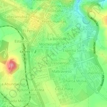
Name: Vera Cruz topographic map, elevation, terrain.
Location: Vera Cruz, Cáceres, Extremadura, Spanje (39.45823 -6.37763 39.46110 -6.37504)
Average elevation: 453 m
Minimum elevation: 407 m
Maximum elevation: 519 m
Other topographic maps
Click on a map to view its topography, its elevation and its terrain.
Mojón del Puntal
Spanje > Extremadura > Cáceres
Mojón del Puntal, Cáceres, Extremadura, Spanje
Average elevation: 365 m