Geolocate

Kakkanad topographic map

Click on the map to display elevation.

About this map

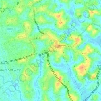
Name: Kakkanad topographic map, elevation, terrain.

Location: Kakkanad, Kanayannur, Ernakulam district, Kerala, 682030, India (9.99657 76.32275 10.03657 76.36275)

Average elevation: 13 m

Minimum elevation: -4 m

Maximum elevation: 35 m

Gear up for your next adventure:

🧰Survival Kit - Essential gear for emergencies in the wilderness
🔦LED Headlamp - Hands-free lighting for early morning starts or late finishes
🧣Evaporative Cooling Towel - Beat the heat during intense summer climbs
🧼Biodegradable Camp Soap - Environmentally friendly cleaning for gear and body
🧴First Aid Kit - Essential first aid supplies for outdoor emergencies

As an Amazon Associate, this site earns from qualifying purchases at no extra cost to you.