Geolocate

Sector 104 topographic map

Click on the map to display elevation.

About this map

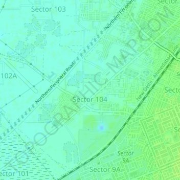
Name: Sector 104 topographic map, elevation, terrain.

Location: Sector 104, Gurgaon, Gurugram District, Haryana, 122006, India (28.46861 76.98083 28.49316 77.00857)

Average elevation: 215 m

Minimum elevation: 210 m

Maximum elevation: 220 m

Other topographic maps

Click on a map to view its topography, its elevation and its terrain.

Badshahpur

India > Haryana > Gurgaon

Average elevation: 228 m

Damdama Lake

India > Haryana > Gurgaon

Average elevation: 242 m

Gear up for your next adventure:

🥾Waterproof Hiking Shoes - Durable shoes for wet and rugged trails
🥾Waterproof Hiking Boots - Boots keeping your feet dry in wet conditions
🧭GPS Outdoor Watch - Smart watch for navigation and fitness tracking in nature
🥾Lightweight Hiking Boots - Boots for comfort and mobility on long hikes
Tent Footprint - Protect tent floor and increase durability

As an Amazon Associate, this site earns from qualifying purchases at no extra cost to you.