
Thank you for supporting this site ❤️
Make a donation
Make a donation
Gear up for your next adventure:
As an Amazon Associate, this site earns from qualifying purchases at no extra cost to you.
Forchtenstein topographic map
Click on the map to display elevation.
Thank you for supporting this site ❤️
Make a donation
Make a donation
Gear up for your next adventure:
As an Amazon Associate, this site earns from qualifying purchases at no extra cost to you.
About this map
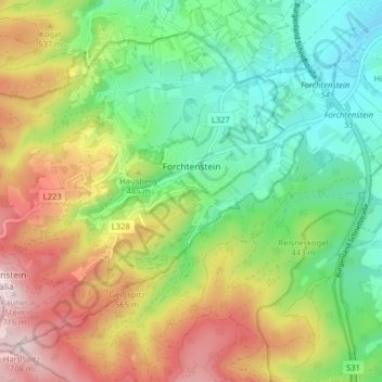
Name: Forchtenstein topographic map, elevation, terrain.
Location: Forchtenstein, Bezirk Mattersburg, Burgenland, 7212, Austria (47.68712 16.29505 47.73218 16.37469)
Average elevation: 432 m
Minimum elevation: 245 m
Maximum elevation: 717 m
Thank you for supporting this site ❤️
Make a donation
Make a donation
Gear up for your next adventure:
As an Amazon Associate, this site earns from qualifying purchases at no extra cost to you.