Geolocate

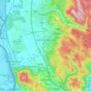
Danube topographic map

Click on the map to display elevation.

About this map

Name: Danube topographic map, elevation, terrain.

Location: Danube, Bratislava-Čunovo, District of Bratislava V, Bratislava, Region of Bratislava, 900 43, Slovakia (48.02483 17.23125 48.02712 17.23730)

Average elevation: 125 m

Minimum elevation: 118 m

Maximum elevation: 134 m

Other topographic maps

Click on a map to view its topography, its elevation and its terrain.

District of Bratislava I

Slovakia > Bratislava

Average elevation: 186 m

District of Bratislava IV

Slovakia > Bratislava

Average elevation: 215 m

Záhorská Bystrica

Slovakia > Bratislava

Average elevation: 250 m

Bratislava-Devín

Slovakia > Bratislava

Average elevation: 199 m

Gear up for your next adventure:

🧦Outdoor Socks - Durable socks designed for hiking and outdoor sports
🧦Crew Hiking Socks - Comfortable socks for long-distance hikes
🔥Emergency Fire Starter - Reliable ignition source for all weather conditions
🧢Hiking Hat - Sun-protective and breathable hats for long treks
⛺Lightweight Camping Tent - Portable shelter optimized for Canadian backcountry camping

As an Amazon Associate, this site earns from qualifying purchases at no extra cost to you.