
Сантандер topographic map
Interactive map
Click on the map to display elevation.
About this map
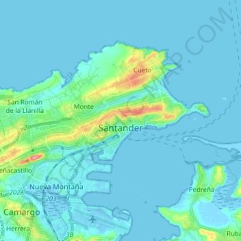
Name: Сантандер topographic map, elevation, terrain.
Location: Сантандер, Santander, Кантабрия, Испания (43.43442 -3.88903 43.49490 -3.76325)
Average elevation: 10 m
Minimum elevation: -5 m
Maximum elevation: 97 m