Geolocate

Pemberton topographic map

Click on the map to display elevation.

About this map
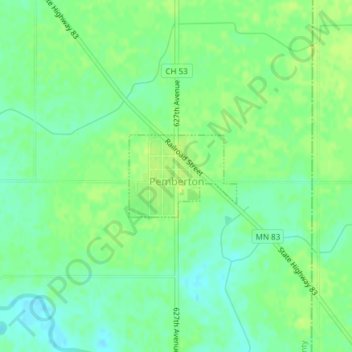
Name: Pemberton topographic map, elevation, terrain.

Location: Pemberton, Blue Earth County, Minnesota, United States (44.00489 -93.78845 44.01122 -93.77695)

Average elevation: 316 m

Minimum elevation: 308 m

Maximum elevation: 322 m

Other topographic maps

Click on a map to view its topography, its elevation and its terrain.

Rapidan

United States > Minnesota > Blue Earth County

Average elevation: 299 m

Gear up for your next adventure:

🧤Rechargeable Heated Gloves - Extreme warmth for Canadian winter expeditions
🧢Hiking Hat - Sun-protective and breathable hats for long treks
🧴Sunscreen SPF - Broad-spectrum sunscreen for outdoor activities
🦯Trekking Poles - Reduced impact on joints for steep topographic climbs
👖Convertible Hiking Pants - Zip-off legs to adapt to changing weather conditions

As an Amazon Associate, this site earns from qualifying purchases at no extra cost to you.