Geolocate

Kalher topographic map

Click on the map to display elevation.

About this map
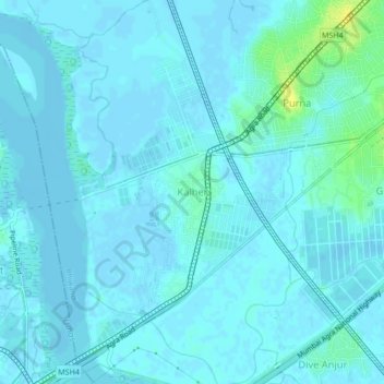
Name: Kalher topographic map, elevation, terrain.

Location: Kalher, Bhiwandi, Thane, Maharashtra, 400607, India (19.22706 72.99621 19.26706 73.03621)

Average elevation: 3 m

Minimum elevation: -3 m

Maximum elevation: 20 m

Gear up for your next adventure:

🛶Waterproof Dry Bags - Keep electronics and clothes dry during river crossings
🐕Hiking Dog Pack - Let your canine companion carry their own water and food
🥾Approach Boots - Comfortable boots for hiking and climbing approaches
📷Outdoor Action Camera - Capture high-elevation views and rugged adventures
🧢Hiking Hat - Sun-protective and breathable hats for long treks

As an Amazon Associate, this site earns from qualifying purchases at no extra cost to you.