Geolocate

Jageshwar topographic map

Click on the map to display elevation.

About this map

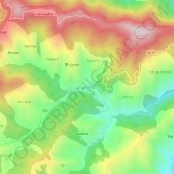
Name: Jageshwar topographic map, elevation, terrain.

Location: Jageshwar, Bhanoli, Almora, Uttarakhand, 263624, India (29.61837 79.83413 29.65837 79.87413)

Average elevation: 1,976 m

Minimum elevation: 1,661 m

Maximum elevation: 2,330 m

Gear up for your next adventure:

🧦Merino Wool Socks - Moisture-wicking comfort for long-distance hiking
🥘Camping Cookware Set - Compact nesting pots and pans for trail cooking
🔭Compact Monocular - One-handed bird watching and trail spotting
🧣Evaporative Cooling Towel - Beat the heat during intense summer climbs
🥾Mountaineering Boots - Supportive boots for climbing and high-altitude hiking

As an Amazon Associate, this site earns from qualifying purchases at no extra cost to you.