Geolocate

Muxi topographic map

Click on the map to display elevation.

About this map

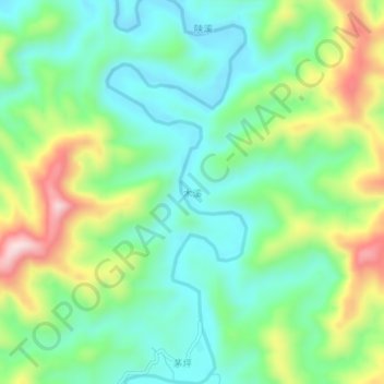
Name: Muxi topographic map, elevation, terrain.

Location: Muxi, Anhua County, Yiyang, Hunan, China (28.30406 111.41326 28.34406 111.45326)

Average elevation: 205 m

Minimum elevation: 91 m

Maximum elevation: 444 m

Gear up for your next adventure:

🔋Solar Power Bank - Keep your GPS and devices charged during long outdoor trips
💡LED Headlamp - Hands-free illumination for night hiking and camping
🧢Hiking Sun Hat - Wide-brimmed protection for exposed mountain ridges
🧢Sun Hat - Wide-brim hat for sun protection
🥾Approach Boots - Comfortable boots for hiking and climbing approaches

As an Amazon Associate, this site earns from qualifying purchases at no extra cost to you.