Geolocate

Oued Lilli topographic map

Click on the map to display elevation.

About this map
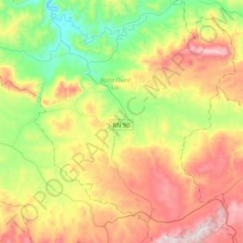
Name: Oued Lilli topographic map, elevation, terrain.

Location: Oued Lilli, Oued Lili District, Tiaret, Algeria (35.39700 1.16934 35.61746 1.39439)

Average elevation: 697 m

Minimum elevation: 316 m

Maximum elevation: 1,221 m

Gear up for your next adventure:

🥾Light Trekking Boots - Supportive boots for multi-day treks
🧥Waterproof Hiking Jacket - Protect yourself from rain and wind while hiking
🦶Anti-Blister Balm - Prevents friction and hotspots during long ascents
🧢Hiking Hat - Sun-protective and breathable hats for long treks
🛏️Camping Sleeping Mat - Comfortable mats for sleeping outdoors

As an Amazon Associate, this site earns from qualifying purchases at no extra cost to you.