Geolocate

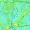
Daikanyamacho topographic map

Click on the map to display elevation.

About this map

Name: Daikanyamacho topographic map, elevation, terrain.

Location: Daikanyamacho, Shibuya, Tokyo, 150-0034, Japan (35.64778 139.70191 35.65349 139.70651)

Average elevation: 31 m

Minimum elevation: 5 m

Maximum elevation: 75 m

Other topographic maps

Click on a map to view its topography, its elevation and its terrain.
七号通り公園

Japan > Shibuya

Average elevation: 40 m

Harajuku

Japan > Shibuya

Average elevation: 37 m

Harajuku

Japan > Shibuya

Average elevation: 37 m

Gear up for your next adventure:

🔥Camping Stove - Portable stoves to cook outdoors with ease
🛶Kayak Accessories - Essential gear for safe and fun kayaking adventures
🥾Waterproof Trail Shoes - Shoes designed to handle wet terrain
🔭Compact Monocular - One-handed bird watching and trail spotting
💧Collapsible Water Bottle - Space-saving water bottle for outdoor activities

As an Amazon Associate, this site earns from qualifying purchases at no extra cost to you.