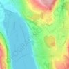
Seengen topographic map
Click on the map to display elevation.
Seengen
The center of this village is located about one kilometer from the lake shore on the eastern edge of the Seetal valley at an altitude of 471 meters above sea level.
About this map

Name: Seengen topographic map, elevation, terrain.
Location: Seengen, Bezirk Lenzburg, Aargau, 5707, Switzerland (47.30855 8.17700 47.34572 8.23473)
Average elevation: 531 m
Minimum elevation: 440 m
Maximum elevation: 722 m
Other topographic maps
Click on a map to view its topography, its elevation and its terrain.