
Sotu Cangues topographic map
Interactive map
Click on the map to display elevation.
About this map
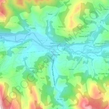
Name: Sotu Cangues topographic map, elevation, terrain.
Location: Sotu Cangues, Cangas de Onís, Asturië, 33589, Spanje (43.32484 -5.10347 43.36484 -5.06347)
Average elevation: 218 m
Minimum elevation: 66 m
Maximum elevation: 561 m
Other topographic maps
Click on a map to view its topography, its elevation and its terrain.
Ñarciandi
Spanje > Asturië > Cangas de Onís > Cangas de Onís / Cangues d'Onís
Ñarciandi, Cangas de Onís / Cangues d'Onís, Cangas de Onís, Asturië, 33589, Spanje
Average elevation: 231 m