
Wasa Lake Provincial Park topographic map
Interactive map
Click on the map to display elevation.
About this map
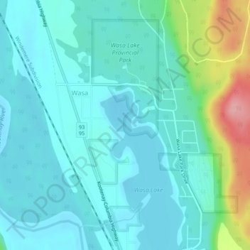
Name: Wasa Lake Provincial Park topographic map, elevation, terrain.
Average elevation: 790 m
Minimum elevation: 765 m
Maximum elevation: 891 m
Other topographic maps
Click on a map to view its topography, its elevation and its terrain.
Wasa Lake
Canada > British Columbia > Regional District of East Kootenay > Area E (Saint Mary/Skookumchuck) > Wasa
Wasa Lake, Wasa, Area E (Saint Mary/Skookumchuck), Regional District of East Kootenay, British Columbia, V0B 2K0, Canada
Average elevation: 793 m