Geolocate

Uelsen topographic map

Click on the map to display elevation.

About this map
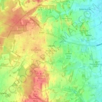
Name: Uelsen topographic map, elevation, terrain.

Location: Uelsen, Samtgemeinde Uelsen, Landkreis Grafschaft Bentheim, Lower Saxony, 49843, Germany (52.46332 6.84523 52.51840 6.92425)

Average elevation: 49 m

Minimum elevation: 18 m

Maximum elevation: 85 m

Other topographic maps

Click on a map to view its topography, its elevation and its terrain.
Gear up for your next adventure:

🧥Thermal Fleece Jacket - Versatile insulation for changing mountain temperatures
🧥Softshell Hiking Jacket - The perfect balance of wind protection and breathability
💡LED Camping Lantern - Illuminate your campsite with long-lasting lanterns
🧤Rechargeable Heated Gloves - Extreme warmth for Canadian winter expeditions
⛺Family Camping Tent - Spacious tent suitable for family camping trips

As an Amazon Associate, this site earns from qualifying purchases at no extra cost to you.