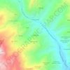
Agnone topographic map
Click on the map to display elevation.
Agnone
Agnone lies on a rocky spear in the mountainous regions of Molise (Alto Molise). Farms and country houses surround the city at elevations varying from 370 m (1,210 ft) above sea level of the Verrino River bed to 1,386 m (4,547 ft) at Monte Castelbarone. The Sangro River also passes by Agnone.
About this map

Name: Agnone topographic map, elevation, terrain.
Location: Agnone, Isernia, Molise, Italy (41.72496 14.29335 41.88091 14.45474)
Average elevation: 883 m
Minimum elevation: 303 m
Maximum elevation: 1,731 m
Other topographic maps
Click on a map to view its topography, its elevation and its terrain.
B o s c o d i M o n t e M i g l i o
Italy > Molise > Isernia > San Pietro Avellana
Average elevation: 1,008 m