Geolocate

Seward topographic map

Click on the map to display elevation.

About this map

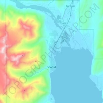
Name: Seward topographic map, elevation, terrain.

Location: Seward, Kenai Peninsula, Alaska, United States (60.08446 -149.47663 60.15423 -149.27312)

Average elevation: 328 m

Minimum elevation: 0 m

Maximum elevation: 1,567 m

Gear up for your next adventure:

🧭Orienteering Kit - Tools for map reading and navigation in the wild
🧥Waterproof Hiking Jacket - Protect yourself from rain and wind while hiking
❄️Traction Ice Cleats - Slip-on spikes for icy trails and winter hiking
🥾Hiking Shoes - Durable and comfortable shoes for trail hiking
Tent Footprint - Protect tent floor and increase durability

As an Amazon Associate, this site earns from qualifying purchases at no extra cost to you.