Geolocate

Utraula topographic map

Click on the map to display elevation.

About this map

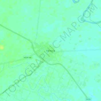
Name: Utraula topographic map, elevation, terrain.

Location: Utraula, Balrampur, Uttar Pradesh, 271604, India (27.27767 82.37957 27.35767 82.45957)

Average elevation: 99 m

Minimum elevation: 95 m

Maximum elevation: 108 m

Gear up for your next adventure:

🔭Compact Binoculars - Lightweight optics for scouting trails and wildlife
🚲MTB Frame Bag - Carry tools and maps directly on your bicycle frame
🥾Hiking Shorts - Breathable shorts suitable for summer hikes
🔪Outdoor Multitool - Versatile tool for repairs and food prep in the wild
🥾Trail Hiking Boots - Supportive boots for rough trails

As an Amazon Associate, this site earns from qualifying purchases at no extra cost to you.