Geolocate

Galveston topographic map

Click on the map to display elevation.

About this map
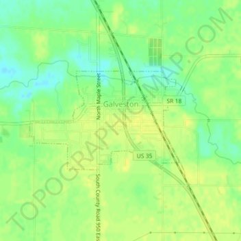
Name: Galveston topographic map, elevation, terrain.

Location: Galveston, Cass County, Indiana, United States (40.57153 -86.20374 40.58260 -86.18164)

Average elevation: 246 m

Minimum elevation: 234 m

Maximum elevation: 253 m

Other topographic maps

Click on a map to view its topography, its elevation and its terrain.

Clymers

United States > Indiana > Cass County

Average elevation: 220 m

Twelve Mile

United States > Indiana > Cass County

Average elevation: 241 m

Gear up for your next adventure:

🥾Hiking Leggings - Comfortable leggings for outdoor activities
🔦LED Headtorch - Bright and durable light for night activities
🧣Merino Neck Gaiter - Protects against wind, sun, and cold at high altitudes
🥽Outdoor Goggles - Protective eyewear for outdoor activities
🥾Waterproof Trail Shoes - Shoes designed to handle wet terrain

As an Amazon Associate, this site earns from qualifying purchases at no extra cost to you.