Geolocate

Dumas topographic map

Click on the map to display elevation.

About this map

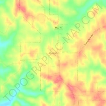
Name: Dumas topographic map, elevation, terrain.

Location: Dumas, Tippah County, Mississippi, 38625, United States (34.62038 -88.86395 34.66038 -88.82395)

Average elevation: 178 m

Minimum elevation: 137 m

Maximum elevation: 208 m

Gear up for your next adventure:

🏃Hydration Running Vest - Carry water and maps close to your body for speed
🦶Hiking Shoe Insoles - Added support for high arches and long days on feet
Camping Coffee Maker - Brew fresh coffee anywhere on the topographic map
👟Leg Gaiters - Keep debris, mud, and snow out of your boots
💧Filtered Water Bottle - Safe drinking water on the go

As an Amazon Associate, this site earns from qualifying purchases at no extra cost to you.