
Nord Gondar topographic map
Interactive map
Click on the map to display elevation.
About this map
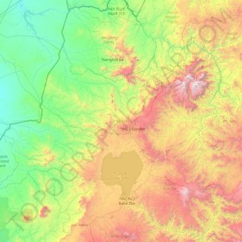
Name: Nord Gondar topographic map, elevation, terrain.
Location: Nord Gondar, Amhara, 6200, Éthiopie (11.64261 35.26165 13.78090 38.74661)
Average elevation: 1,440 m
Minimum elevation: 481 m
Maximum elevation: 4,450 m