Geolocate

Sewall's Point topographic map

Click on the map to display elevation.

About this map

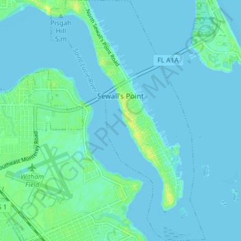
Name: Sewall's Point topographic map, elevation, terrain.

Location: Sewall's Point, Martin County, Florida, United States (27.16637 -80.22008 27.22130 -80.18037)

Average elevation: 3 m

Minimum elevation: -2 m

Maximum elevation: 16 m

Other topographic maps

Click on a map to view its topography, its elevation and its terrain.

Hobe Sound

United States > Florida > Martin County

Average elevation: 5 m

Gear up for your next adventure:

🧥Softshell Jacket - Windproof and breathable jacket for hiking
🗺️Topographic Maps - Detailed maps to explore trails, mountains, and wilderness areas
🥾Trail Hiking Shoes - Durable shoes designed for rugged trails
🧦Outdoor Socks - Durable socks designed for hiking and outdoor sports
🦶Anti-Blister Balm - Prevents friction and hotspots during long ascents

As an Amazon Associate, this site earns from qualifying purchases at no extra cost to you.