Geolocate

Castelletta topographic map

Click on the map to display elevation.

About this map
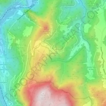
Name: Castelletta topographic map, elevation, terrain.

Location: Castelletta, Fabriano, Ancona, Marche, Italia (43.38260 12.98760 43.42260 13.02760)

Average elevation: 514 m

Minimum elevation: 173 m

Maximum elevation: 1,056 m

Gear up for your next adventure:

⛺Camping Tent - Weather-resistant tents suitable for 2 to 6 people
🎒Hiking Backpack - Lightweight and ergonomic backpacks for day hikes or multi-day treks
🍽️Titanium Camping Spork - Ultralight and indestructible eating utensil
🧰Emergency Multi-Tool - Compact multi-tool for outdoor survival
🥾Lightweight Hiking Shoes - Comfortable shoes for day hikes

As an Amazon Associate, this site earns from qualifying purchases at no extra cost to you.