Geolocate

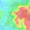
Maisoncelles topographic map

Click on the map to display elevation.

About this map

Name: Maisoncelles topographic map, elevation, terrain.

Location: Maisoncelles, Mamers, Sarthe, Pays de la Loire, Metropolitan France, 72440, France (47.92489 0.54285 47.95168 0.61324)

Average elevation: 157 m

Minimum elevation: 123 m

Maximum elevation: 174 m

Other topographic maps

Click on a map to view its topography, its elevation and its terrain.

Pontenchéri

France > Pays de la Loire > Sarthe > Courdemanche

Average elevation: 112 m

L'Armenaudière

France > Pays de la Loire > Sarthe > Écommoy

Average elevation: 116 m

La Thibaudière

France > Pays de la Loire > Sarthe > Arçonnay

Average elevation: 158 m

Gear up for your next adventure:

🥾Waterproof Hiking Boots - Boots keeping your feet dry in wet conditions
🛰️Satellite Messenger - Emergency communication for areas with no cell service
🪑Ultralight Camping Stool - Compact seating for rest stops during long hikes
🧳Compression Sacks - Maximize space in your backpack by shrinking gear
🧦Thermal Socks - Warm socks for winter hiking or camping

As an Amazon Associate, this site earns from qualifying purchases at no extra cost to you.