Geolocate

Sultan topographic map

Click on the map to display elevation.

About this map

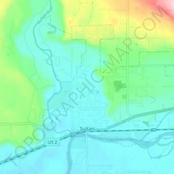
Name: Sultan topographic map, elevation, terrain.

Location: Sultan, Snohomish County, Washington, 98294, United States (47.85686 -121.83429 47.88915 -121.76721)

Average elevation: 78 m

Minimum elevation: 24 m

Maximum elevation: 271 m

Other topographic maps

Click on a map to view its topography, its elevation and its terrain.

Gear up for your next adventure:

🧥Softshell Jacket - Windproof and breathable jacket for hiking
Tent Footprint - Protect tent floor and increase durability
🥾Trail Hiking Boots - Supportive boots for rough trails
🧰Survival Kit - Essential gear for emergencies in the wilderness
🧢Outdoor Visor - Breathable visor for sunny hikes

As an Amazon Associate, this site earns from qualifying purchases at no extra cost to you.