Geolocate

Banal topographic map

Click on the map to display elevation.

About this map
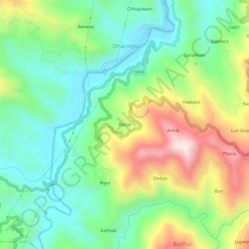
Name: Banal topographic map, elevation, terrain.

Location: Banal, Dharmpur, Mandi, Himachal Pradesh, 175040, India (31.76974 76.73851 31.80974 76.77851)

Average elevation: 827 m

Minimum elevation: 624 m

Maximum elevation: 1,197 m

Gear up for your next adventure:

🧶550 Survival Paracord - Versatile utility cord for emergency repairs and rigging
🥾Lightweight Hiking Shoes - Comfortable shoes for day hikes
🧥Ultralight Puffy Jacket - Maximum warmth that packs down to the size of an orange
🛏️Camping Sleeping Mat - Comfortable mats for sleeping outdoors
🥾Hiking Shorts - Breathable shorts suitable for summer hikes

As an Amazon Associate, this site earns from qualifying purchases at no extra cost to you.