Geolocate

Muñó topographic map

Click on the map to display elevation.

About this map

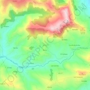
Name: Muñó topographic map, elevation, terrain.

Location: Muñó, Siero, Asturias, 33510, España (43.41493 -5.66656 43.45493 -5.62656)

Average elevation: 346 m

Minimum elevation: 190 m

Maximum elevation: 565 m

Gear up for your next adventure:

🦯Trekking Poles - Reduced impact on joints for steep topographic climbs
🔦LED Flashlight - Powerful and long-lasting flashlight for camping and emergencies
🛌Down Sleeping Bag - Superior warmth-to-weight ratio for cold nights
🧴Bear Spray Holster - Quick-access carry for essential Canadian wilderness safety
💡LED Camping Lantern - Illuminate your campsite with long-lasting lanterns

As an Amazon Associate, this site earns from qualifying purchases at no extra cost to you.