Geolocate

Lexington topographic map

Click on the map to display elevation.

About this map

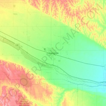
Name: Lexington topographic map, elevation, terrain.

Location: Lexington, Dawson County, Nebraska, 68850, United States (40.61885 -99.90149 40.93885 -99.58149)

Average elevation: 753 m

Minimum elevation: 702 m

Maximum elevation: 841 m

Gear up for your next adventure:

🧢Hiking Hat - Sun-protective and breathable hats for long treks
🔭Compact Monocular - One-handed bird watching and trail spotting
🥾Approach Shoes - Shoes designed for climbing approaches and rugged trails
🧰Survival Kit - Essential gear for emergencies in the wilderness
👖Convertible Hiking Pants - Zip-off legs to adapt to changing weather conditions

As an Amazon Associate, this site earns from qualifying purchases at no extra cost to you.