Geolocate

Lathrop topographic map

Click on the map to display elevation.

Lathrop

Lathrop is located at 37°49′1″N 121°17′19″W / 37.81694°N 121.28861°W / 37.81694; -121.28861 (37.816904, -121.288633). The San Joaquin River is on the west side of Lathrop and has elevation of 20 feet (7 m).

About this map

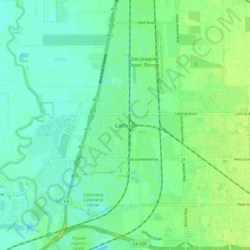
Name: Lathrop topographic map, elevation, terrain.

Location: Lathrop, San Joaquin County, California, 305, United States (37.78270 -121.31661 37.86270 -121.23661)

Average elevation: 7 m

Minimum elevation: -7 m

Maximum elevation: 14 m

Gear up for your next adventure:

🕯️Camping Lantern - Illuminates your entire campsite with high-efficiency LEDs
🎒Backpack Rain Cover - External shield to keep your entire pack dry
🪑Insulated Seat Pad - Protect your seat from cold rocks and wet logs
🦯Trekking Poles - Reduced impact on joints for steep topographic climbs
🛶Waterproof Dry Bags - Keep electronics and clothes dry during river crossings

As an Amazon Associate, this site earns from qualifying purchases at no extra cost to you.