
Tamghas topographic map
Interactive map
Click on the map to display elevation.
About this map
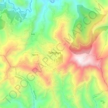
Name: Tamghas topographic map, elevation, terrain.
Location: Tamghas, Resunga, Gulmi, Lumbini Province, Nepal (28.04894 83.21109 28.08667 83.29153)
Average elevation: 1,450 m
Minimum elevation: 815 m
Maximum elevation: 2,312 m