Geolocate

Rialp topographic map

Click on the map to display elevation.

About this map

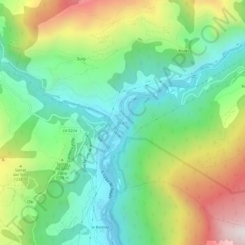
Name: Rialp topographic map, elevation, terrain.

Location: Rialp, Pallars Sobirá, Lérida, Cataluña, 25594, España (42.42300 1.11549 42.46300 1.15549)

Average elevation: 1,064 m

Minimum elevation: 690 m

Maximum elevation: 1,759 m

Gear up for your next adventure:

🧼Travel Hand Sanitizer - Keep hands clean when water is scarce
🥾Waterproof Trail Shoes - Shoes designed to handle wet terrain
🥾Mountain Trail Shoes - High-traction shoes for mountain trails
🥾All-Terrain Hiking Boots - Versatile boots for varied hiking conditions
🔦LED Headlamp - Hands-free lighting for early morning starts or late finishes

As an Amazon Associate, this site earns from qualifying purchases at no extra cost to you.