Geolocate

Bighorn topographic map

Click on the map to display elevation.

About this map

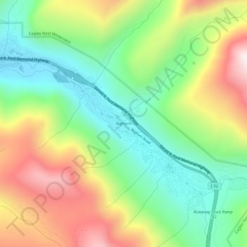
Name: Bighorn topographic map, elevation, terrain.

Location: Bighorn, Vail, Eagle County, Colorado, United States (39.61665 -106.31725 39.65665 -106.27725)

Average elevation: 2,894 m

Minimum elevation: 2,530 m

Maximum elevation: 3,442 m

Gear up for your next adventure:

🧢Outdoor Visor - Breathable visor for sunny hikes
🛶Kayak Accessories - Essential gear for safe and fun kayaking adventures
🔋Lithium AA Batteries - Long-lasting power that performs in extreme cold
🧤Thermal Hiking Gloves - Grip-enhanced gloves for cold-weather altitude trekking
Camping Groundsheet - Protect your tent from moisture and dirt

As an Amazon Associate, this site earns from qualifying purchases at no extra cost to you.