Geolocate

Daxberg topographic map

Click on the map to display elevation.

About this map

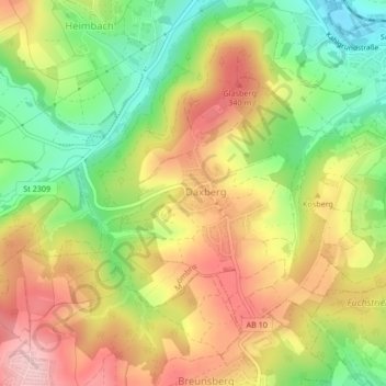
Name: Daxberg topographic map, elevation, terrain.

Location: Daxberg, Mömbris, Landkreis Aschaffenburg, Bayern, Deutschland (50.03652 9.15187 50.05558 9.18009)

Average elevation: 268 m

Minimum elevation: 170 m

Maximum elevation: 364 m

Gear up for your next adventure:

🧦Hiking Socks - Moisture-wicking and comfortable socks for long hikes
🧭GPS Handheld Device - Reliable GPS navigation for outdoor adventures
🧣Evaporative Cooling Towel - Beat the heat during intense summer climbs
Lightweight Backpacking Tent - Compact tent for efficient hiking trips
🥾Approach Shoes - Shoes designed for climbing approaches and rugged trails

As an Amazon Associate, this site earns from qualifying purchases at no extra cost to you.