Geolocate

USENDA topographic map

Click on the map to display elevation.

About this map

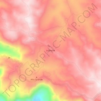
Name: USENDA topographic map, elevation, terrain.

Location: USENDA, Silvia, Centro, Cauca, Colombia (2.60675 -76.48822 2.64675 -76.44822)

Average elevation: 2,398 m

Minimum elevation: 2,009 m

Maximum elevation: 2,528 m

Other topographic maps

Click on a map to view its topography, its elevation and its terrain.

QUIZGO

Colombia > Cauca > Silvia

Average elevation: 2,803 m

Gear up for your next adventure:

🏃Hydration Running Vest - Carry water and maps close to your body for speed
🧭GPS Outdoor Watch - Smart watch for navigation and fitness tracking in nature
🛶Canoe Life Vest - Safety vest for water sports
🩹Moleskin Blister Pads - Direct protection for painful foot pressure points
🥾Trail Running Shoes - Lightweight and durable shoes for trail running

As an Amazon Associate, this site earns from qualifying purchases at no extra cost to you.