Geolocate

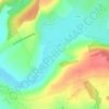
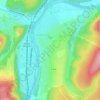
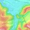
Tourteron topographic map

Click on the map to display elevation.

About this map

Name: Tourteron topographic map, elevation, terrain.

Location: Tourteron, Vouziers, Ardennes, Grand Est, Metropolitan France, 08130, France (49.52495 4.61484 49.56049 4.66479)

Average elevation: 170 m

Minimum elevation: 115 m

Maximum elevation: 217 m

Other topographic maps

Click on a map to view its topography, its elevation and its terrain.
Roche Bayart

France > Grand Est > Ardennes > Château Regnault

Average elevation: 221 m

Crecy

France > Grand Est > Ardennes > Brieulles-sur-Bar

Average elevation: 198 m

La Rubrique

France > Grand Est > Ardennes > Château Regnault

Average elevation: 251 m

Le Hamai

France > Grand Est > Ardennes > Villers-sur-Bar

Average elevation: 175 m

Chiers

France > Grand Est > Ardennes > La Ferté-sur-Chiers

Average elevation: 186 m

La Fontaine des Parades

France > Grand Est > Ardennes > Buzancy

Average elevation: 242 m

Mont Vireux

France > Grand Est > Ardennes > Vireux-Molhain

Average elevation: 151 m

La Rubrique

France > Grand Est > Ardennes > Château Regnault

Average elevation: 251 m

Prau

France > Grand Est > Ardennes > Vireux-Wallerand

Average elevation: 155 m

Georgea

France > Grand Est > Ardennes > L'Écaille

Average elevation: 95 m

Forest

France > Grand Est > Ardennes > Seraincourt

Average elevation: 167 m

Richat

France > Grand Est > Ardennes > Fromelennes

Average elevation: 165 m

Gear up for your next adventure:

⛺Camping Tent - Weather-resistant tents suitable for 2 to 6 people
🥤Collapsible Travel Cup - Saves space and weight in your mess kit
💧Reusable Water Bottle - Durable water bottles for hydration on trails
🏃Hydration Running Vest - Carry water and maps close to your body for speed
👟Leg Gaiters - Keep debris, mud, and snow out of your boots

As an Amazon Associate, this site earns from qualifying purchases at no extra cost to you.