Geolocate

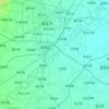
Lingdongcun topographic map

Click on the map to display elevation.

About this map

Name: Lingdongcun topographic map, elevation, terrain.

Location: Lingdongcun, Baoding City, Hebei, China (39.06560 115.14205 39.10560 115.18205)

Average elevation: 199 m

Minimum elevation: 136 m

Maximum elevation: 468 m

Other topographic maps

Click on a map to view its topography, its elevation and its terrain.

Nandayuan

China > Hebei > Baoding City

Average elevation: 19 m

Qingyuan District

China > Hebei > Baoding City

Average elevation: 20 m

Laiyuan County

China > Hebei > Baoding City

Average elevation: 1,013 m

Acient Lotus Pool

China > Hebei > Baoding City

Average elevation: 22 m

Acient Lotus Pool

China > Hebei > Baoding City

Average elevation: 22 m

Gear up for your next adventure:

🥾Light Hiking Boots - Lightweight and comfortable boots for day hikes
🎒Hiking Daypack - Lightweight and durable backpacks for day trips and excursions
🧊Insulated Water Bottle - Keeps drinks cold in summer and prevents freezing in winter
🛶Canoe Life Vest - Safety vest for water sports
⛺Camping Tent - Weather-resistant tents suitable for 2 to 6 people

As an Amazon Associate, this site earns from qualifying purchases at no extra cost to you.