
Lac Opocopa topographic map
Interactive map
Click on the map to display elevation.
About this map
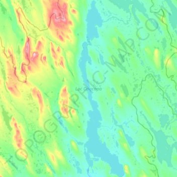
Name: Lac Opocopa topographic map, elevation, terrain.
Average elevation: 560 m
Minimum elevation: 518 m
Maximum elevation: 751 m
Other topographic maps
Click on a map to view its topography, its elevation and its terrain.
Rivière-Mouchalagane
Canada > Quebec > Rivière-Mouchalagane
Rivière-Mouchalagane, Caniapiscau, Côte-Nord, Quebec, Canada
Average elevation: 607 m