Geolocate

Okuma topographic map

Click on the map to display elevation.

About this map
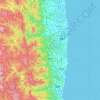
Name: Okuma topographic map, elevation, terrain.

Location: Okuma, Futaba County, Fukushima Prefecture, Japan (37.37208 140.85370 37.45020 141.29444)

Average elevation: 224 m

Minimum elevation: -1 m

Maximum elevation: 870 m

Gear up for your next adventure:

🧥Waterproof Hiking Jacket - Protect yourself from rain and wind while hiking
🧊Insulated Water Bottle - Keeps drinks cold in summer and prevents freezing in winter
⛺Camping Tent - Weather-resistant tents suitable for 2 to 6 people
🔥Emergency Fire Starter - Reliable ignition source for all weather conditions
🚲Bike Repair Kit - Essential tools for on-trail mechanical issues

As an Amazon Associate, this site earns from qualifying purchases at no extra cost to you.