Geolocate

Bluff topographic map

Click on the map to display elevation.

About this map
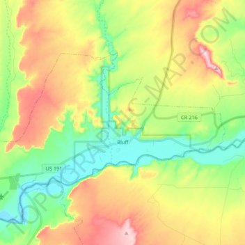
Name: Bluff topographic map, elevation, terrain.

Location: Bluff, San Juan County, Utah, 84512, United States (37.25709 -109.64793 37.33135 -109.48441)

Average elevation: 1,424 m

Minimum elevation: 1,303 m

Maximum elevation: 1,594 m

Gear up for your next adventure:

🦯Trekking Poles - Reduced impact on joints for steep topographic climbs
🌡️Emergency Mylar Blankets - Compact thermal protection for unexpected nights outdoors
🧴Outdoor Sunscreen - High SPF protection for high-altitude UV exposure
🥾Trail Hiking Boots - Supportive boots for rough trails
🎒Hiking Daypack - Lightweight and durable backpacks for day trips and excursions

As an Amazon Associate, this site earns from qualifying purchases at no extra cost to you.