Geolocate

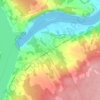
Hanwell Rural Community topographic map

Click on the map to display elevation.

About this map

Name: Hanwell Rural Community topographic map, elevation, terrain.

Location: Hanwell Rural Community, York County, New Brunswick, Canada (45.74211 -66.92666 45.97333 -66.69942)

Average elevation: 100 m

Minimum elevation: -10 m

Maximum elevation: 226 m

York County trails, hiking, mountain biking, running and outdoor activities

Other topographic maps

Click on a map to view its topography, its elevation and its terrain.

McGivney

Canada > New Brunswick > York County > McGivney

Average elevation: 179 m

Kingsclear

Canada > New Brunswick > York County

Average elevation: 76 m

Douglas

Canada > New Brunswick > York County > Fredericton

Average elevation: 48 m

Kingsclear

Canada > New Brunswick > York County

Average elevation: 76 m

Kingsclear

Canada > New Brunswick > York County

Average elevation: 76 m

Gear up for your next adventure:

🧥Thermal Fleece Jacket - Versatile insulation for changing mountain temperatures
🔋Solar Power Bank - Keep your GPS and devices charged during long outdoor trips
🏃Hydration Running Vest - Carry water and maps close to your body for speed
🥾Lightweight Hiking Boots - Boots for comfort and mobility on long hikes
⛺Camping Essentials - All-in-one gear for a comfortable camping trip

As an Amazon Associate, this site earns from qualifying purchases at no extra cost to you.