
Wolmirstedt topographic map
Interactive map
Click on the map to display elevation.
About this map
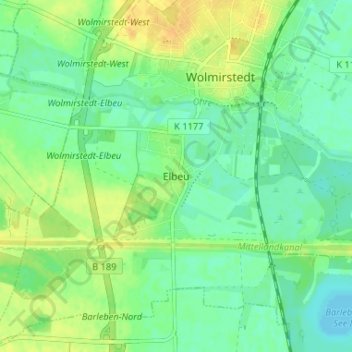
Name: Wolmirstedt topographic map, elevation, terrain.
Location: Wolmirstedt, Elbeu, Börde, Sachsen-Anhalt, 39326, Deutschland (52.21719 11.59850 52.25719 11.63850)
Average elevation: 48 m
Minimum elevation: 37 m
Maximum elevation: 61 m