

Inman topographic map
Click on the map to display elevation.
About this map
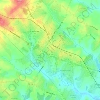
Name: Inman topographic map, elevation, terrain.
Location: Inman, Spartanburg County, South Carolina, United States (35.02171 -82.11114 35.06696 -82.07248)
Average elevation: 287 m
Minimum elevation: 253 m
Maximum elevation: 341 m
Other topographic maps
Click on a map to view its topography, its elevation and its terrain.


Croft State Park
United States > South Carolina > Spartanburg County > Pauline
Average elevation: 207 m


East Spartanburg
United States > South Carolina > Spartanburg County > Spartanburg
Average elevation: 227 m


Croft State Park Lake Dam
United States > South Carolina > Spartanburg County
Average elevation: 191 m

Pacolet Mills
United States > South Carolina > Spartanburg County > Central Pacolet
Average elevation: 188 m


East Spartanburg
United States > South Carolina > Spartanburg County > Spartanburg
Average elevation: 227 m

