Geolocate

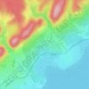
Gic topographic map

Click on the map to display elevation.

About this map

Name: Gic topographic map, elevation, terrain.

Location: Gic, Pápai járás, Veszprém, Transdanubia, 8435, Hungary (47.38251 17.70432 47.47290 17.78714)

Average elevation: 184 m

Minimum elevation: 141 m

Maximum elevation: 273 m

Other topographic maps

Click on a map to view its topography, its elevation and its terrain.
Veszprém

Hungary > Veszprém > Veszprém

Average elevation: 275 m

Saint George's Hill

Hungary > Veszprém > Raposka

Average elevation: 175 m

Péterhegy

Hungary > Veszprém > Csopak

Average elevation: 169 m

Magyar

Hungary > Veszprém > Balatonhenye

Average elevation: 315 m

Gyermekváros

Hungary > Veszprém > Zánka

Average elevation: 133 m

Zichy-kastély

Hungary > Veszprém > Várpalota

Average elevation: 166 m

Körtvélyes

Hungary > Veszprém > Tés

Average elevation: 460 m

Gear up for your next adventure:

🧥Softshell Jacket - Windproof and breathable jacket for hiking
🧣Evaporative Cooling Towel - Beat the heat during intense summer climbs
💡Compact LED Flashlight - Powerful and portable flashlight for outdoor use
⛺Camping Tent - Weather-resistant tents suitable for 2 to 6 people
🧴Waterproofing Spray - Restore the DWR coating on jackets and tents

As an Amazon Associate, this site earns from qualifying purchases at no extra cost to you.