
Beusichem topographic map
Interactive map
Click on the map to display elevation.
About this map
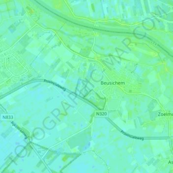
Name: Beusichem topographic map, elevation, terrain.
Location: Beusichem, Buren, Geldern, Niederlande (51.93263 5.24192 51.96543 5.31098)
Average elevation: 4 m
Minimum elevation: -1 m
Maximum elevation: 9 m
Other topographic maps
Click on a map to view its topography, its elevation and its terrain.
Ravenswaaij
Niederlande > Geldern > Buren
Ravenswaaij, Buren, Geldern, Niederlande
Average elevation: 4 m