Geolocate

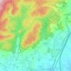
Les Rangées topographic map

Click on the map to display elevation.

About this map

Name: Les Rangées topographic map, elevation, terrain.

Location: Les Rangées, Vingt-Hanaps, Écouves, Alençon, Orne, Normandie, France métropolitaine, 61250, France (48.49680 0.11764 48.53680 0.15764)

Average elevation: 186 m

Minimum elevation: 147 m

Maximum elevation: 293 m

Other topographic maps

Click on a map to view its topography, its elevation and its terrain.
Radon

France > Normandie > Orne > Écouves

Average elevation: 228 m

Gear up for your next adventure:

🛁Quick-Dry Microfiber Towel - Space-saving towel that dries rapidly on the move
🩹Moleskin Blister Pads - Direct protection for painful foot pressure points
🧥Insulated Jacket - Keep warm in cold outdoor conditions
🥾Light Hiking Boots - Lightweight and comfortable boots for day hikes
❄️Traction Ice Cleats - Slip-on spikes for icy trails and winter hiking

As an Amazon Associate, this site earns from qualifying purchases at no extra cost to you.