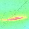
Sinjar Mountains topographic map
Click on the map to display elevation.
Sinjar Mountains
The Sinjar Mountains (Kurdish: چیایێ شنگالێ, romanized: Çîyayê Şengalê, Arabic: جبل سنجار, romanized: Jabal Sinjār, Syriac: ܛܘܪܐ ܕܫܝܓܪ, romanized: Ṭura d'Shingar), is a 100-kilometre-long (62 mi) mountain range that runs east to west, rising above the surrounding alluvial steppe plains in northwestern Iraq to an elevation of 1,463 meters (4,800 ft). The highest segment of these mountains, about 75 km (47 mi) long, lies in the Nineveh Governorate. The western and lower segment of these mountains lies in Syria and is about 25 km (16 mi) long. The city of Sinjar is just south of the range. These mountains are regarded as sacred by the local Yazidis.
About this map

Name: Sinjar Mountains topographic map, elevation, terrain.
Location: Sinjar Mountains, Sinjar District, Nineveh Governorate, Iraq (36.29813 41.31880 36.42824 42.12101)
Average elevation: 451 m
Minimum elevation: 275 m
Maximum elevation: 1,444 m
Other topographic maps
Click on a map to view its topography, its elevation and its terrain.