Geolocate

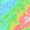
Ferpeyret topographic map

Click on the map to display elevation.

About this map

Name: Ferpeyret topographic map, elevation, terrain.

Location: Ferpeyret, Les Molettes, Revel, Grenoble, Isère, Auvergne-Rhône-Alpes, France métropolitaine, 38420, France (45.16795 5.89233 45.18795 5.91233)

Average elevation: 1,197 m

Minimum elevation: 705 m

Maximum elevation: 2,158 m

Other topographic maps

Click on a map to view its topography, its elevation and its terrain.
38420

France > Auvergne-Rhône-Alpes > Isère > Revel > Les Molettes

Average elevation: 1,038 m

Gear up for your next adventure:

⛺Lightweight Camping Tent - Portable shelter optimized for Canadian backcountry camping
👟Trail Running Shoes - Agile footwear for fast-paced topographic exploration
🔋Emergency Crank Radio - Weather alerts and power without needing batteries
🥾Waterproof Hiking Boots - Essential footwear for rugged terrain and wet Canadian trails
🧼Biodegradable Camp Soap - Environmentally friendly cleaning for gear and body

As an Amazon Associate, this site earns from qualifying purchases at no extra cost to you.