Geolocate

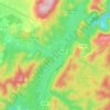
La Grille topographic map

Click on the map to display elevation.

About this map

Name: La Grille topographic map, elevation, terrain.

Location: La Grille, Tanneron, Draguignan, Var, Provence-Alpes-Côte d'Azur, France métropolitaine, 83440, France (43.56822 6.85717 43.60822 6.89717)

Average elevation: 248 m

Minimum elevation: 20 m

Maximum elevation: 498 m

Other topographic maps

Click on a map to view its topography, its elevation and its terrain.
Gear up for your next adventure:

🧥Ultralight Puffy Jacket - Maximum warmth that packs down to the size of an orange
🧰Survival Kit - Essential gear for emergencies in the wilderness
🧥Softshell Jacket - Windproof and breathable jacket for hiking
🧊Insulated Water Bottle - Keeps drinks cold in summer and prevents freezing in winter
🧤Rechargeable Heated Gloves - Extreme warmth for Canadian winter expeditions

As an Amazon Associate, this site earns from qualifying purchases at no extra cost to you.